Category Archives: higher education

Global Conversations around GIS and Education

Tomorrow we’ll host the 2nd in the Americas’ series of panel discussions around what it means to be a resilient educator of GIS and GIScience, and what it means to implement technologies in support of that outcome. The Europe/Africa one has already taken place, the Asia-Pacific one yet to come. Info about these can be found here: https://www.globalgiscienceeducation.org/, and I encourage people to join, listen, share.

COVID has been a disruptive factor, obviously, but these conversations have uprooted much more that has been problematic for years. Too much expected of too few, too little capacity to connect dots. Why every summer do we keep wondering what textbook to adopt when only a fraction of students buy or read the book? Shouldn’t we be doing something a little differently? A lot differently?

a GIS kind of week

A friend from work asked me today if I quilted and from there it became an opportunity to upload some new quilt pictures, then it became pretty clear that I hadn’t actually posted anything new in a very long time.

We all know what kind of crazy it’s been this COVID-year so no need to go there. So I’ll just talk about the last five days: compiling these GIScience/GIS instructional resources, getting news that the article I wrote with Tom Wikle about GIS Certificate programs was now out in Transactions in GIS, wrestling with the new server that hosts the GIS&T Body of Knowledge and chatting with colleagues about its future platform, making more plans for the global Resiliency in GIScience Education panels that are taking place, and writing letters of support for in-going proposal to do great things with GIS & GIScience.

I’m now starting to update my own upcoming fall 2020 class at Cornell (Intro to Mapping & Spatial Analysis with GIS) to use QGIS instead of my usual ArcGIS Pro. Why? The labs, which will have maybe 20% of the students in-person, at least that’s the plan today. Most are Mac-users, living and learning who-knows-where in these times, and most of the class will be online and otherwise suffering through small-laptop-screen-itis via the painful clumsiness of AppsOnDemand, plus its awkward data saving manipulations. Just can’t do it. Way too many other stressful factors in the world today to not simplify this one thing, for at least this one semester. And this way I also get to work more with Keith Jenkins, our very own QGIS superstar support colleague, who was super busy last month with the QGIS North America conference. Yay for Keith.

A Few Hits and a Miss

Last week I had the pleasure of speaking at the annual conference that Harvard’s Center for Geographic Analysis holds. This year the theme was Space & Time in Data Science, and panelists shared stories and nuggets of wisdom for the audience of geographers, geographic information scientists, computer scientists, statisticians, data scientists, and others. Upon prompting for a show of hands about who fell into the different disciplinary categories, many confessed to wearing multiple hats among those roles. Which I think was one point of this event: to foster multi-disciplinary conversations in a place where there aren’t enough going on naturally.

Some of the more noteworthy comments were from:

  • Francisca Dominici, a biostatistician and co-Director of Harvard’s Data Science Initiative, whilst talking about methods for causal inference and scientific reproducibility, wondering whether in fact there exists *anything* that we can really control so we can make inferences about today’s world. She described the CGA as an entity able to help connect the data science talents across campus.
  • Peter Fox, from RPI. He shared the success that the knowledge network behind the Deep Carbon Observatory has been and was refreshingly forthcoming in his description of how attempts at a University Network of Things hasn’t worked. I am increasingly interested in research infrastructure, and knowledge networks are an important component. As an aside, they have a GIS for Science class at RPI but nothing from the syllabus distinguishes it from basic intro GIS course that uses open-source software and apps.
  • Amelia McNamara who had a fountain of ideas I liked, including the notion of an “interactive essay” – like this one one Exploring Histograms. I will definitely be having my students play with this Spatial-Aggregation Explorer.  How Spatial Polygons Shape Our World (YouTube link) officially makes her an honorary geographer in my book. Except I’m not sure she wants to be one. She’s doing just fine with her own disciplines.

I had the second-to-the last slot in the last panel of the day. My own comments focused on the role of strategic communication for strategic bridge building (to better connect GIScience & data scientists). Strategic was to be the key word. I’d say four of my five ideas were reasonably on target but one went up in flames rather spectacularly.

I happen to know one (very bright, very engaged) data scientist who works at a data science company in the Silicon Valley, one that I’d never heard of before (or until recently, since). During a conversation with him earlier this year, I learned that he doesn’t know anything about GIScience AND he’d be interested in knowing more. That was that, and I totally forgot the name of his company until I looked him up again while preparing my talk.

So, on Friday afternoon I said that “data science start-ups might be a good place to broker some worthwhile conversations about GIScience,” and I included a screenshot from the website of the company I’d been holding up as an example, vis a vis their young data scientist who expressed curiosity about GIScience: Palantir.

It was late on a Friday afternoon, at the very end of a long day of intellectual prompts, technical rigor, and gobbledy-gook jargon. Brains were noticeably over-saturated. Time remaining only for a few questions or comments for the panelists. The first person who spoke is a GIScientist known for her critical (i.e., in the academic sense) observations. At that moment I really had no idea what she was saying. Her language may have seemed extra circuitous because my brain was tired or she was politely trying to be less direct. The only thing I really heard was her final emphatic statement that “… we’re not going to work with Palantir!”

Wait, what? She knows the company too? Yup, that Palantir. That’s the one. The one that I suggested to a crowd at Harvard that we GIScientists ought to play more with in the sandbox. Maybe not so strategic after all.

I was nicely wisened up by a few folks as we were departing the conference. In the big scheme of things, as we say in Portuguese, não faz mal.

But I’m left with a bunch of conflicted feelings. I still think that conversations with data scientists at start-ups are a good thing. Not everyone working at Company P is mal-intentioned and sneaky, especially and definitely not my data scientist friend. Life is what you do, not what you say, so we let our actions speak for themselves. I spend way too much time sitting in a small home office by myself in a centrally-isolated patch of land in upstate New York. I crave the chance to develop and brainstorm ideas for talks with colleagues and within a community of practice. I sometimes learn from my mistakes.

Tracking GIS&T Degrees vs. Workforce

And another thing, told in simple terms from this landing-page image you too can create from this Data USA site.  That number of degrees awarded in 2016 (1,923, which they measure as growing at 5.31%). In 2013, they calculated that there were 1,419 GIS&T degrees granted.

BUT, the “people in the workforce” number, 3.63 million, comes from a much larger group of graduates: all of those considered to have degrees in the “social sciences.” That is not a very helpful way for us to track GIS&T graduates!  We really have no good or confident sense of where graduates are ultimately getting jobs. Tracking recent graduates is notoriously difficult, and I can personally attest to that.

Is our supply of GIS&T graduates well aligned, in quantity and quality, with the actual jobs that they want to go into and that they’re qualified to go into?  A $64,000 question, or if you believe this figure, a $90,421 dollar question (which is ALSO using data from “Social Sciences”!).

ScreenHunter_493 Apr. 24 08.44

Treasure of data access for GIS&T domain

I was about to jump into my regularly scheduled workday when I came across this data visualization tool for educational statistics, whose primary sources are EXACTLY the same ones that I’d been exploring yesterday. How weird is that. And that they had data about “Geographic Information Science & Cartography” at the 6-digit level (much more specific), much more interesting than what they consider its default “comparison” group, “social sciences” at the 2-digit level.

The measurements of “skills” for GIS&T showed a tremendous revealed comparative advantage (RCA) for negotiation, critical thinking, coordination, plus many management of (time/material resources/financial resources) ones. Complex problem solving is the only one that’s also high from another group of skills. RCA is “how much greater or lesser that skill’s rating is than the average,” which I guess means the average rating for that skill for other employment areas (?).  It’s not a surprise that these are high, but it it is interesting that programming and technology design have such a little RCA for us.

ScreenHunter_491 Apr. 24 08.06

Data from O’NET, Department of Labor.

And then there are the tree diagrams of the number of degrees awarded themselves. What’s not very helpful are how they’ve lumped things together into the shaded groups. There is much diversity within each group when you scan across the yellowish ones and the hospital-scrubs-green ones. Like in 2013 when both Texas State University and University of Maine at Machias (hi Tora) are both in the yellow set.  Orange-shaded ones seem to consistently be the community college set.

For the year 20132013 Tree Map of Institutions for Geographic Information Science & Cartography Majors

and for the year 2016:

2016 Tree Map of Institutions for Geographic Information Science & Cartography Majors

Much to explore further here and how lovely that we can download the data themselves. Thank you, open government.

geospatial Professional Certification options

OGC, the Open Geospatial Consortium, is hosting a survey to collect thoughts on OGC-related Professional Certifications. I’m a huge fan of the mission of OGC and its methods as well, and to allow someone to earn a credential in this area should increase the likelihood of advancing towards greater adoption and implementation. Being anxious about credentials – designed and managed and articulated-well – is short-sighted.

That time of the semester again

This week we’ll broach the topic of datums, coordinate systems, and map projections in the GIS class that I teach at Cornell. It’s week 5+ of the semester, just enough into this stuff so that there’s some sustained knowledge growing and they now have enough of a framework onto which to hang the obvious-but-abstract-and-necessary-but-confusing-and-powerful topic.  I used to be more GIS-traditional about this stuff and dive in during weeks 2 or 3. Not any more. Much more and deeper learning taking place now that students are more confident and competent at managing and manipulating spatial data. T

Just in time, XKCD has come up with another inspired projections example to share with the class.

Journal of Geography Article Earns National Council for Geographic Education Accolade

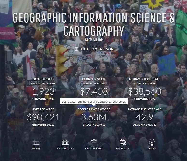
A joint effort from Esri Education manager Tom Baker and a research group of seven university faculty members was selected as the Best Article for Geography Program Development by the National Council for Geographic Education (NCGE). Published in the Journal of Geography, the co-authored piece, entitled "A Research Agenda for Geospatial Technologies and Learning," provides a blueprint for advancing the study of geospatial technology (GST) in relation to education and learning.

“Research that advances understanding from and in GST has long been sparse, so the methodology outlined in A Research Agenda for Geospatial Technologies and Learning is not only insightful, it’s also an innovative asset for future studies to come,” said Zachary Dulli, NCGE chief executive officer. “As a collaborative effort of interdisciplinary academia and experts in spatial cognition, the resultant agenda stands out for being mindful of objectivity and a multitude of approaches to instructing GST, constructing curriculum, professional development, and achieving learning.”

In addition to Baker, article contributors included Sarah Battersby of the University of South Carolina, Sarah W. Bednarz of Texas A&M University, Alec M. Bodzin of Lehigh University, Bob Kolvoord of James Madison University, Steven Moore of the University of Redlands, Diana Sinton of Cornell University, and David Uttal of Northwestern University.

“All the authors sincerely appreciate this acknowledgement from the National Council for Geographic Education,” Tom Baker said. “Geospatial tools evolve rapidly, and our knowledge of learning processes with these tools needs to grow just to keep pace.”

Because of limited understanding regarding learning and GST, the agenda calls for a broad framework that is both systematic and replicable. Forthcoming studies should be evidence based, draw upon relevant theory, accurately describe the steps involved, connect concept and evidence, and apply to a range of settings and populations.

"Only cross-disciplinary, dynamic, and concerted research efforts will shed much-needed light on how we perceive, organize, understand, and communicate while learning with geospatial tools," Baker said. "We believe this agenda is one of the first significant steps in that direction and hope it encourages more researchers to incorporate the agenda in their future work."

NCGE will acknowledge the article contributors on Saturday, July 30 during its annual National Conference on Geography Education taking place in Tampa, Florida.

To read "A Research Agenda for Geospatial Technologies and Learning" in full, visit http://arcg.is/1X9nNfS.

# # #

About Esri
Since 1969, Esri has been giving customers around the world the power to think and plan geographically. The market leader in GIS, Esri software is used in more than 350,000 organizations worldwide including each of the 200 largest cities in the United States, most national governments, more than two-thirds of Fortune 500 companies, and more than 7,000 colleges and universities. Esri applications, running on more than one million desktops and thousands of Web and enterprise servers, provide the backbone for the world's mapping and spatial analysis. Esri is the only vendor that provides complete technical solutions for desktop, mobile, server, and Internet platforms. Visit us at www.esri.com.

Esri, the Esri globe logo, GIS by Esri, ArcGIS, http://www.esri.com, and @esri.com are trademarks, registered trademarks, or service marks of Esri in the United States, the European Community, or certain other jurisdictions. Other companies and products mentioned herein may be trademarks or registered trademarks of their respective trademark owners.

Press Information:
Karen Richardson, Esri
Tel.: 909-793-2853, extension 1-3491
E-mail (press only): press@esri.com
General Information: info@esri.com

Future of R with GIS

I was a total newbie to R before spring 2014. Then it was a little trial by fire, trying to learn just enough to keep up with grad students in a class I was co-teaching. Thank goodness for the “co-” part, as my partner was an expert in the topic, and I could contribute in my own areas of expertise, which were/are not R!  But I finished the semester with a new-found respect and, frankly, awe for what is possible with R. I have much to learn, and maybe, someday, the time.

Fast forward a few months and the topic keeps cropping up.  I shared a beer in Salzburg with Lex Comber and learned about one of his forthcoming publications, an Intro to R for Spatial Analysis and Mapping. Haven’t got my own copy yet, but if it’s what it seems to be, it’ll be one of my assigned texts in the future. In one of our webinars, Trisalyn Nelson spoke about her use of R with her graduate students. And today, I silently scanned through Alex Singleton‘s recent presentation on the Changed Face of GIS, in which R figures prominently for him.  There’s something going on here that some smart people have figured out.

What’s my new job?

Since the summer, I have been working for UCGIS, the University Consortium for Geographic Information Science, as their Executive Director.  Translation: I manage the business-related operations of a small non-profit that’s focused on advancing and supporting the research and education ideas of the GIS-teaching faculty at its 50+ member institutions.  Today, Directions Magazine printed an interview I did with them about UCGIS and some of its upcoming activities.  And, it’s International GIS Day! Woo-hoo!