Our capacity to understand and know through representations of information yields deep opportunities, like Maps of Science and these scientific visualizations profiled in Wired Magazine.
It’s thinking with space.

Our capacity to understand and know through representations of information yields deep opportunities, like Maps of Science and these scientific visualizations profiled in Wired Magazine.
It’s thinking with space.
Posted in education, spatial thinking
Origami involves spatial thinking along all stages. Imagine being the one generating the original set of instructions for a design.
MIT has a whole paper folding club (?). Paper folders make good engineers.
Origami can also involve curves, and some people choose origami as their livelihood. (links from GreatMap).
Origami – one spatial way to make your brain work well. Here is a list of other spatial activities, and not only for children.
Posted in education, games, spatial thinking
Here’s the 2nd part of NITLE’s podcast interview with Julio Rivera, the geographer at Carthage College who’s now their provost. Well worth a listen for his thoughts on spatial learning.
Posted in geography, GIS, higher education, spatial thinking
Ikea’s iconic instructions, applied to construction long ago. First page is hilarious, second loses its clever edge.
Assembly diagrams like these are classic examples of thinking in space.
Posted in humor, spatial thinking
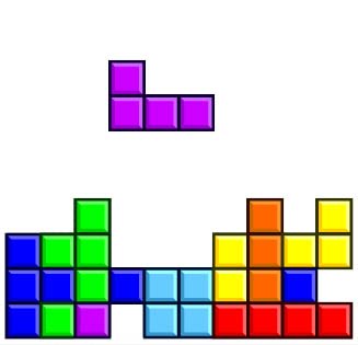
I’m intrigued and amused by the legacy of Tetris, in so many ways. It’s caught the attention of numerous scientists who study cross-entropy, artificial intelligence, and norm-based social learning. I love it for its connections to spatial abilities, as talked about here, and here, and here. Its ability to focus your mind may even help with post-traumatic stress disorder. And we even have insight into those games that end so poorly.
Posted in games, spatial thinking
NITLE has just posted part 1 of its interview with Julio Rivera from Carthage College. I first met Julio several years ago when we coordinated a presentation/workshop on GIS at a Council on Undergraduate Research meeting; he’s very involved with and supportive of CUR.
Posted in geography, higher education, spatial thinking
Came across this Jan 2003 posting by Reg Golledge on Thinking Spatially in an old Directions Media page. He was really the first person who ever inspired me to think about this “across” everything else.
I never knew him but I sure do like his ideas.
RIP, Reg.
Posted in spatial thinking
Research in GIS Education
Research about GIS in Education
Education about GIS Research
Research on Education using GIS
Care about any of these? Join our Google Group.
Posted in GIS, higher education, spatial thinking
Leicester, Leicester, rhymes with Chester. I’m in England for the first of a 3-week Fellowship awarded by SPLINT. (Next two weeks will be in May 2010.) The 8-hr time difference between here and California complicated yesterday but now things seeming slowly more sensical in my mind. I’m staying at the home of one of the faculty members in the geography department, Pete Fisher, a man whose name I have known for many years and whose books I have on my shelves, but I didn’t even connect the dots when I sat in his kitchen yesterday!
Oh well.
Off for some breakfast and to explore the city a bit.
Posted in geography, spatial thinking
